-
BLAEU'S MAP
In 1629, W.J. Blaeu printed a new world atlas containing 45 maps. One of these was a map of the Holy Land as seen by Moses from Mt. Nevo just before his death and after forty years of wandering with the Israelites in the desert.
The cartouche on the bottom right is surrounded by the figures of Moses and Aaron. In this image, Moses had just descended from Mt. Sinai with the Tablets and is shown according to Jerome's mistaken translation of Exodus 34:29, with horns over his head. Next to him stands Aaron, the High Priest, in his special attire and paraphernalia.
The Wanderings of the Children of Israel in the desert
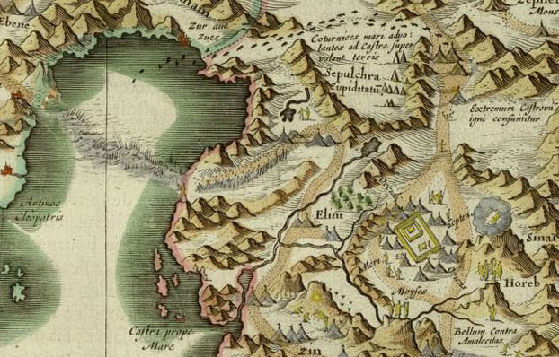
The story of Moses and the Wanderings of the Children of Israel in the desert is shown here in miniature drawings: on the left the Children of Israel are seen crossing the parted Red Sea, their following route through the desert being marked by a yellow trail. On the right the revelation at Mount Sinai, as well as the Tabernacle and the various camps of the Israelites are depicted.
 Blaeu, map of the Holy Land, Amsterdam, 1629, NLI, Cartouche - Moses and Aaron
 Blaeu, map of the Holy Land, Amsterdam, 1629, the route of the Children of Israel in the desert
 Blaeu, map of the Holy Land, Amsterdam, 1629, NLI
 -
SEUTTER'S MAP
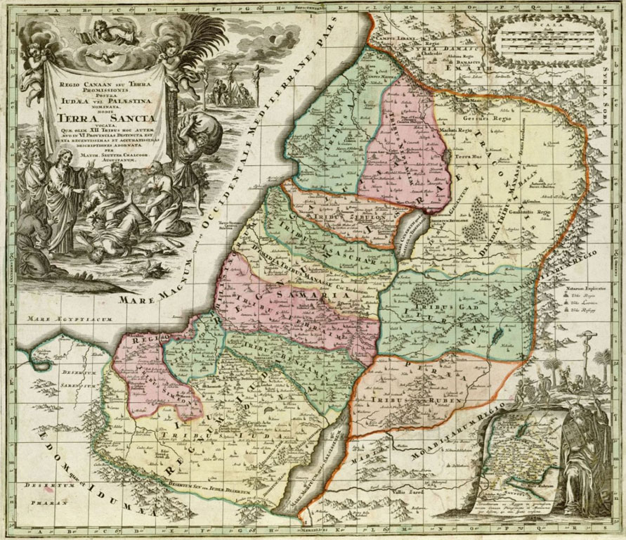
Matthaeus Seutter's map of Palestine was part of his atlas, which was popular in Europe in the 18th century. The map, based on a prototype made a century earlier by Sanson, aims to depict the Holy Land to the Christian European audience from the First Temple until the Roman period, covering the period of the events told in the Old and New Testament. Equally important, is the scene on the top left, showing Jesus exorcising a demon, watched from above by God and the Holy Spirit, with the Crucifixion in the background. On the bottom right the route of the Exodus from Egypt is depicted separately.
 Seutter, map of the Holy Land, Augsburg, 1725, NLI
 -
A DUTCH MAP
This map was drawn in the Netherlands, following Ortelius's map of the Holy Land around 1600. The anonymous artist added to Ortelius' map a series of illustrations, including Jonah being tossed to the mouth of the big fish and Israelite figures crossing the desert. At the bottom right the twelve tribes are encamped in the Sinai Desert, and on the bottom right the Grotto of the Nativity in Bethlehem is depicted. Interestingly, the North in the compass rose is pointing to the south!
 Anonymous, map of the Holy Land, Netherlands, beginning of 17th century, NLI