Christians throughout the ages were drawn to Jerusalem, captivated by its glorious past: it was the city into which according to Christian tradition Jesus made his Triumphal Entry, the stage upon which the events of the Great Week took place, and the place of his Crucifixion and Resurrection and the Ascension. It was also the city of David and Solomon and the setting of a multitude of biblical events. Although many pilgrims and scholars purported to depict "modern" Jerusalem, their maps often followed much earlier maps, and their main aim was to map out the Christian sites, usually ignoring the Muslim presence in the city.
![de Hooghe, map of Jerusalem, Amsterdam, [167-], NLI](http://gizra.github.io/CDL/pages/EA722CB1-C926-E708-A0CF-FD4515FA7174/de Hooghe, map of Jerusalem, Amsterdam, [167-], NLI.jpg)
-
DAUMONT'S MAP
Jean François Daumont made this beautiful map of Jerusalem in 1780. However, it was actually copied from a map originally drawn almost 300 years beforehand, in 1486, following the pilgrimage of Bernhard of Breydenbach to Jerusalem in 1483.
Daumont marks Christian and Muslim monuments with a cross or crescent, but does not name the Muslim monuments. In fact, Daumont chooses to call the mosques on the Temple Mount by their Crusader name: "Templum Salomonis", preferring history to reality.
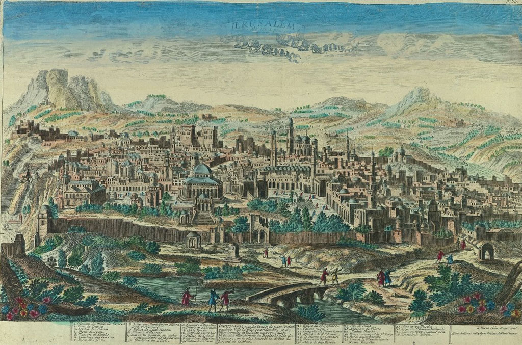 Daumont, map of Jerusalem, Paris, 1780, NLI
 -
BRAUN AND HOGENBERG'S MAP
This view of Jerusalem was one of three maps of the city included in the famous city atlas compiled by Braun and Hoghenberg, in 1575. The quotation from Ezek. 5:5 at the top of the map conveys the idea of Jerusalem as the center of the earth, while the citation from Pliny the Elder on the bottom left lauds "Jerusalem, the most famous of the cities in the Orient, Metropolis of Judaea".
The city is seen here from the perspective of pilgrims standing on the Mount of Olives, looking eastwards. Although the round shape of the city is schematic, there are various realistic elements such as the citadel in the background, the bridges over the Kidron valley and the blocked doorway to the church of the Holy Sepulcher.
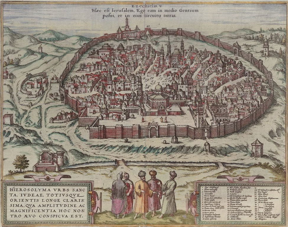 Hogenberg, Braun and Jansson, map of Jerusalem, Amsterdam, 1657, NLI
 -
DAPPER'S MAP
Dapper (1635-1689), who never travelled outside Holland, collected a lot of information about the Holy Land and many other countries. His realistic map (1677) relied on the map made by Bernardino Amico, a Franciscan monk in Jerusalem between1593-1597. Amico, in fact, copied a map made by another Franciscan monk, Antonio d'Angelis, who had served in Jerusalem a few years before; his map continued to be copied by generations of Christian map-makers.
The map does not identify the religious affiliation of the monuments with a cross or crescent, and calls the mosques on the Temple Mount – "The Pagan Church".
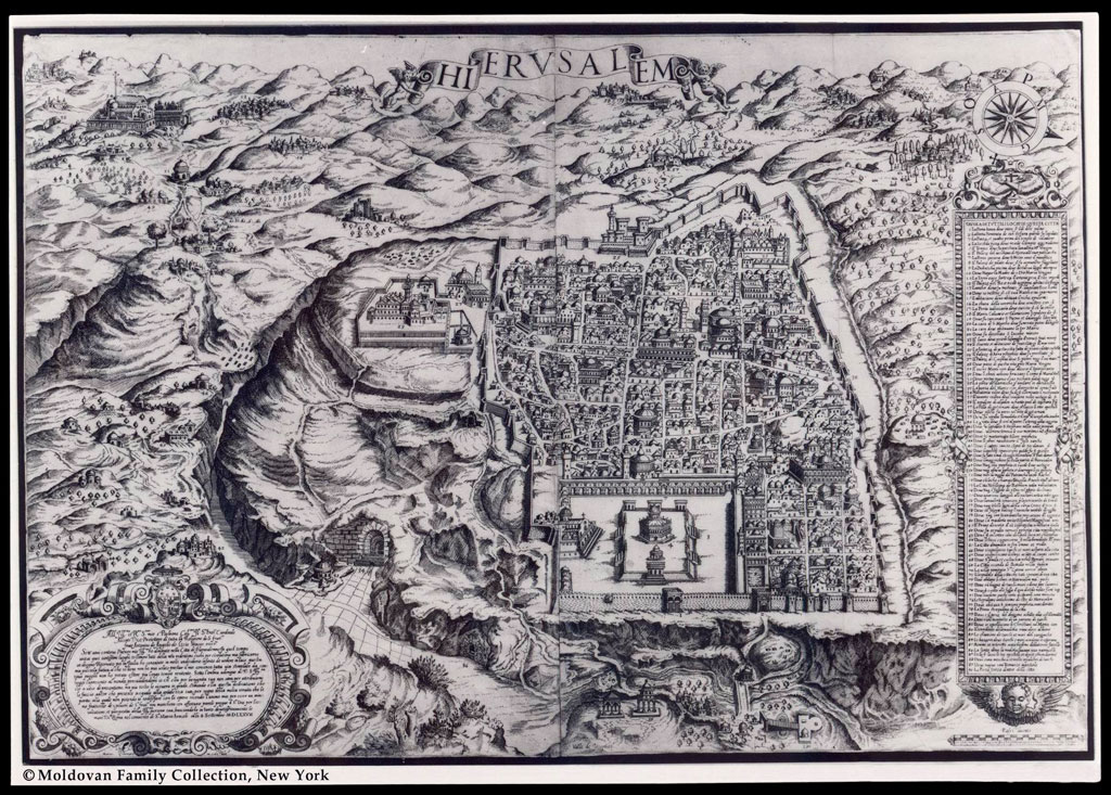 Antonino de Angelis, map of Jerusalem, Rome, 1578, Alfred Moldovan Collection, New-YorkDapper, map of Jerusalem, 'De Stadt Ierusalem zoot Hedendaeghs Bevonden wordt' Amsterdam, 1677, NLI
 -
MONDHARE'S MAP
This landscape drawn by L. Mondhare in 1770, portrays Ottoman Jerusalem as a city commanded by towering minarets and crescents in a surreal mixture of imagination and reality. Prominently situated towards the left of the map is the Dome of the Rock while in the center the Church of the Holy Sepulcher stands out clearly. At the front of the sketch is the Kidron River, usually a dry riverbed, appearing as a broad, rushing, European style river. The inscription at the bottom states that the City of David and Solomon is currently controlled by the Ottomans and notes the existence of a Franciscan monastery within the city.
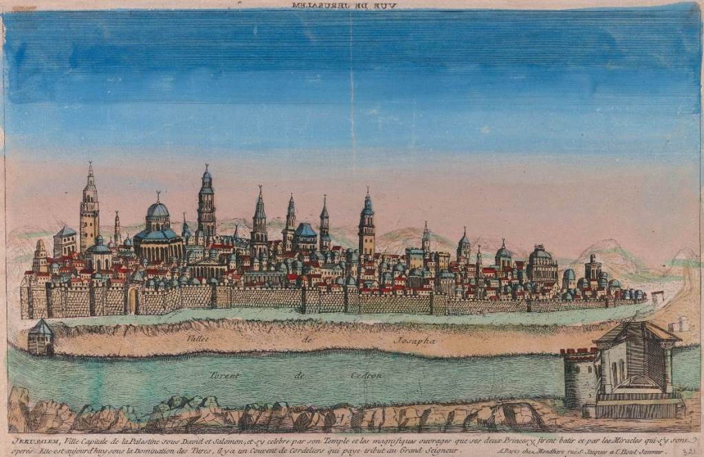 Mondhare, Jerusalem, Paris 1770, 'Jerusalem Ville Capitale de la Palestine sous David et Salomon', NLI